| Adelaide South Australia | |||||||||
|---|---|---|---|---|---|---|---|---|---|
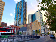
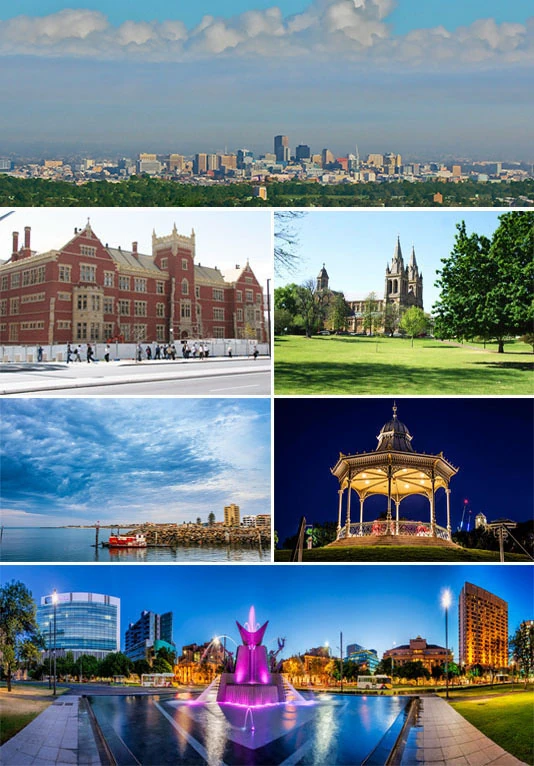 From top to bottom, left to right: Central Adelaide from Mount Lofty, the UniSA Building on North Terrace, St Peter's Cathedral, the beachside suburb of Glenelg, a rotunda in Elder Park, and Victoria Square illuminated in the evening | |||||||||
| Population | 1,376,601 (2020) (5th) | ||||||||
| • Density | 422.296/km2 (1,093.742/sq mi) (2011) | ||||||||
| Established | 28 December 1836 | ||||||||
| Area | 3,259.8 km2 (1,258.6 sq mi) | ||||||||
| Time zone | ACST (UTC+9:30) | ||||||||
| • Summer (DST) | ACDT (UTC+10:30) | ||||||||
| Location | |||||||||
| State electorate(s) | Adelaide | ||||||||
| |||||||||
Adelaide (/ˈædəleɪd/ (Audio file "En-au-Adelaide.oga" not found) AD-ə-layd) is the capital city of South Australia, the state's largest city and the fifth-most populous city of Australia. "Adelaide" may refer to either Greater Adelaide (including the Adelaide Hills) or the Adelaide city centre. The demonym Adelaidean is used to denote the city and the residents of Adelaide. Adelaide city centre was originally inhabited by a group of Kaurna people and known as Tarndanyangga ("place of the red kangaroo") – now the dual name of Victoria Square in the middle of the city – or Tarndanya.
Adelaide is situated on the Adelaide Plains north of the Fleurieu Peninsula, between the Gulf St Vincent in the west and the Mount Lofty Ranges in the east. Its metropolitan area extends 20 km (12 mi) from the coast to the foothills of the Mount Lofty Ranges, and stretches 96 km (60 mi) from Gawler in the north to Sellicks Beach in the south.
Named in honour of Queen Adelaide, the city was founded in 1836 as the planned capital for the only freely-settled British province in Australia. Colonel William Light, one of Adelaide's founding fathers, designed the city centre and chose its location close to the River Torrens. Light's design, now listed as national heritage, set out the city centre in a grid layout known as "Light's Vision", interspaced by wide boulevards and large public squares, and entirely surrounded by parklands.
Early colonial Adelaide was shaped by the diversity and wealth of its free settlers, in contrast to the convict history of other Australian cities. Until the post-war era, it was Australia's third most populated city. It has been noted for its leading examples of religious freedom and progressive political reforms, and became known as the "City of Churches" due to its diversity of faiths. Today, Adelaide is recognised for its many festivals and sporting events, its food and wine, its coastline and hills, and its large defence and manufacturing sectors. Adelaide's quality of life has ranked consistently highly in various measures through the 21st century, at one stage being named Australia's most liveable city.
As South Australia's government and commercial centre, Adelaide is the site of many governmental and financial institutions. Most of these are concentrated in the city centre along the cultural boulevards of North Terrace and King William Street.
History[]
Before European settlement[]
Approximate extent of Kaurna territory, based on the description by Amery (2000)
Before its proclamation as a British settlement in 1836, the area around Adelaide was inhabited by the Indigenous Kaurna people, one of many Aboriginal nations in South Australia. The city and parklands area was known as Tarntanya, Tandanya (now the short name of Tandanya National Aboriginal Cultural Institute), Tarndanya, or Tarndanyangga (now the dual name for Victoria Square) in the Kaurna language. The surrounding area was an open grassy plain with patches of trees and shrub which had been managed by hundreds of generations. Kaurna country encompassed the plains which stretched north and south of Tarntanya as well as the wooded foothills of the Mt Lofty Ranges. The River Torrens was known as the Karrawirra Pari (red gum forest river). About 300 Kaurna populated the Adelaide area, and were referred to by the settlers as the Cowandilla.
Within a few decades of European settlement of South Australia, Kaurna culture was almost completely destroyed; the last speaker of Kaurna language died in 1929. Extensive documentation by early missionaries and other researchers has enabled a modern revival of both, which has included a commitment by local and state governments to rename or include Kaurna names for many local places.
19th century[]
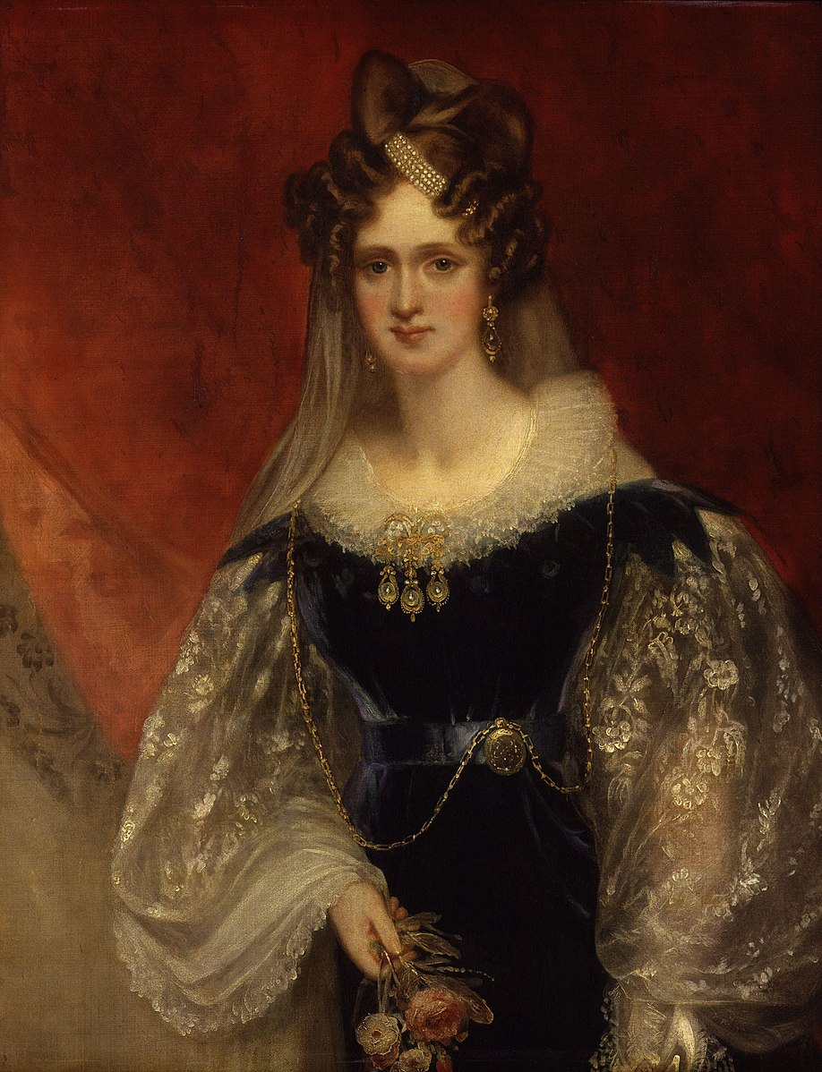
Queen Adelaide, after whom the city was named

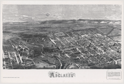
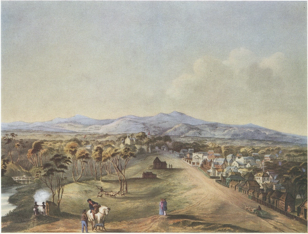
In July 1876, the Illustrated Sydney News published a special supplement that included an early aerial view of the City of Adelaide: (South) Adelaide (the CBD), River Torrens, and portion of North Adelaide from a point above Strangways Terrace, North Adelaide.
South Australia was officially established as a British Province in England in February 1836. The first governor proclaimed the commencement of colonial government in South Australia on 28 December 1836, near The Old Gum Tree in what is now the suburb of Glenelg North. The event is commemorated in South Australia as Proclamation Day. The site of the colony's capital was surveyed and laid out by Colonel William Light, the first Surveyor-General of South Australia, with his own original, unique, topographically sensitive design. Claims of the design being by the architect George Strickland Kingston have been thoroughly debunked. The city was named after Queen Adelaide.
Adelaide was established as a planned colony of free immigrants, promising civil liberties and freedom from religious persecution, based upon the ideas of Edward Gibbon Wakefield. Wakefield had read accounts of Australian settlement while in prison in London for attempting to abduct an heiress,[1] and realised that the eastern colonies suffered from a lack of available labour, due to the practice of giving land grants to all arrivals.[2] Wakefield's idea was for the Government to survey and sell the land at a rate that would maintain land values high enough to be unaffordable for labourers and journeymen.[3] Funds raised from the sale of land were to be used to bring out working-class emigrants, who would have to work hard for the monied settlers to ever afford their own land.[4] As a result of this policy, Adelaide does not share the convict settlement history of other Australian cities like Sydney, Brisbane and Hobart.
North Terrace in 1841
As it was believed that in a colony of free settlers there would be little crime, no provision was made for a gaol in Colonel Light's 1837 plan. But by mid-1837 the South Australian Register was warning of escaped convicts from New South Wales and tenders for a temporary gaol were sought. Following a burglary, a murder, and two attempted murders in Adelaide during March 1838, Governor Hindmarsh created the South Australian Police Force (now the South Australia Police) in April 1838 under 21-year-old Henry Inman.[5] The first sheriff, Samuel Smart, was wounded during a robbery, and on 2 May 1838 one of the offenders, Michael Magee, became the first person to be hanged in South Australia. William Baker Ashton was appointed governor of the temporary gaol in 1839, and in 1840 George Strickland Kingston was commissioned to design Adelaide's new gaol. Construction of Adelaide Gaol commenced in 1841.
Adelaide's early history was marked by economic uncertainty and questionable leadership. The first governor of South Australia, John Hindmarsh, clashed frequently with others, in particular the Resident Commissioner, James Hurtle Fisher. The rural area surrounding Adelaide was surveyed by Light in preparation to sell a total of over 405 km2 of land. Adelaide's early economy started to get on its feet in 1838 with the arrival of livestock from Victoria, New South Wales and Tasmania. Wool production provided an early basis for the South Australian economy. By 1860, wheat farms had been established from Encounter Bay in the south to Clare in the north.
1888 map of Adelaide, showing the gradual development of its urban layout
George Gawler took over from Hindmarsh in late 1838 and, despite being under orders from the Select Committee on South Australia in Britain not to undertake any public works, promptly oversaw construction of a governor's house, the Adelaide Gaol, police barracks, a hospital, a customs house and a wharf at Port Adelaide. Gawler was recalled and replaced by George Edward Grey in 1841. Grey slashed public expenditure against heavy opposition, although its impact was negligible at this point: silver was discovered in Glen Osmond that year, agriculture was well underway, and other mines sprung up all over the state, aiding Adelaide's commercial development. The city exported meat, wool, wine, fruit and wheat by the time Grey left in 1845, contrasting with a low point in 1842 when one-third of Adelaide houses were abandoned.
Trade links with the rest of the Australian states were established after the Murray River was successfully navigated in 1853 by Francis Cadell, an Adelaide resident. South Australia became a self-governing colony in 1856 with the ratification of a new constitution by the British parliament. Secret ballots were introduced, and a bicameral parliament was elected on 9 March 1857, by which time 109,917 people lived in the province.
In 1860 the Thorndon Park reservoir was opened, finally providing an alternative water source to the now turbid River Torrens. Gas street lighting was implemented in 1867, the University of Adelaide was founded in 1874, the South Australian Art Gallery opened in 1881 and the Happy Valley Reservoir opened in 1896. In the 1890s Australia was affected by a severe economic depression, ending a hectic era of land booms and tumultuous expansionism. Financial institutions in Melbourne and banks in Sydney closed. The national fertility rate fell and immigration was reduced to a trickle. The value of South Australia's exports nearly halved. Drought and poor harvests from 1884 compounded the problems, with some families leaving for Western Australia. Adelaide was not as badly hit as the larger gold-rush cities of Sydney and Melbourne, and silver and lead discoveries at Broken Hill provided some relief. Only one year of deficit was recorded, but the price paid was retrenchments and lean public spending. Wine and copper were the only industries not to suffer a downturn.
20th century[]
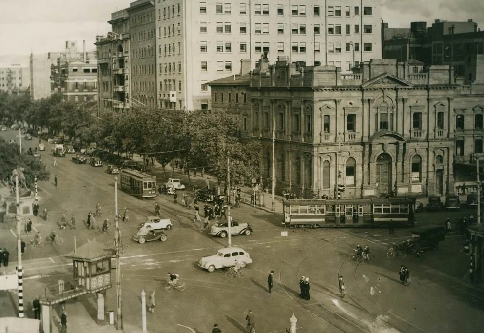
Intersection of North Terrace and King William Street viewed from Parliament House, 1938.

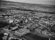
Aerial view of Adelaide in 1935, when it was Australia's third largest city. Note: Only the eastern half of Parliament House is completed.
Adelaide was Australia's third largest city for most of the 20th century. Electric street lighting was introduced in 1900 and electric trams were transporting passengers in 1909. 28,000 men were sent to fight in World War I. Historian F. W. Crowley examined the reports of visitors in the early 20th century, noting that "many visitors to Adelaide admired the foresighted planning of its founders", as well as pondering the riches of the young city.[6] Adelaide enjoyed a postwar boom, entering a time of relative prosperity. Its population grew, and it became the third most populous metropolitan area in the country, after Sydney and Melbourne. Its prosperity was short-lived, with the return of droughts and the Great Depression of the 1930s. It later returned to fortune under strong government leadership. Secondary industries helped reduce the state's dependence on primary industries. World War II brought industrial stimulus and diversification to Adelaide under the Playford Government, which advocated Adelaide as a safe place for manufacturing due to its less vulnerable location.[7] Shipbuilding was expanded at the nearby port of Whyalla.
The South Australian Government in this period built on former wartime manufacturing industries but neglected cultural facilities which meant South Australia's economy lagged behind. International manufacturers like General Motors Holden and Chrysler When Chrysler stopped manufacturing in Adelaide, Mitsubishi Motors Australia Limited took over the Tonsley Park factory. After many years of mixed fortunes, Mitsubishi ceased manufacturing at Tonsley Park on 27 March 2008 made use of these factories around the Adelaide area in suburbs like Elizabeth, completing its transformation from an agricultural service centre to a 20th-century motor city. The Mannum–Adelaide pipeline brought River Murray water to Adelaide in 1955 and an airport opened at West Beach in 1955. Flinders University and the Flinders Medical Centre were established in the 1960s at Bedford Park, south of the city. Today, Flinders Medical Centre is one of the largest teaching hospitals in South Australia. In the post-war years around the early 1960s Adelaide was surpassed by Brisbane as Australia's third largest city. The Dunstan Governments of the 1970s saw something of an Adelaide 'cultural revival', establishing a wide array of social reforms. The city became noted for its progressivism as South Australia became the first Australian state or territory to decriminalise homosexuality between consenting adults in 1975. It also became a centre for the arts, building upon the biennial "Adelaide Festival of Arts" that commenced in 1960. Adelaide hosted the Formula One Australian Grand Prix between 1985 and 1996 on a street circuit in the city's east parklands; it moved to Melbourne in 1996. The State Bank collapsed in 1991 during an economic recession; the effects lasted until 2004, when Standard & Poor's reinstated South Australia's AAA credit rating. From 1999 until 2020, the Adelaide 500 Supercars race has made use of sections of the former Formula One circuit. Adelaide's tallest building, completed in 2020, is called the Adelaidean and is located at 11 Frome Street.
21st century[]
In the early years of the 21st century, a significant increase in the state government's spending on Adelaide's infrastructure occurred. The Rann government invested A$535 million in a major upgrade of the Adelaide Oval to enable AFL to be played in the city centre[8] and more than A$2 billion to build a new Royal Adelaide Hospital on land adjacent to the Adelaide Railway Station.[9] The Glenelg tramline was extended through the city to Hindmarsh[10] down to East Terrace and the suburban railway line extended south to Seaford.[11]
Following a period of stagnation in the 1990s and 2000s, Adelaide began several major developments and redevelopments. The Adelaide Convention Centre was redeveloped and expanded at a cost of A$350 million beginning in 2012.[12] Three historic buildings were adapted for modern use: the Torrens Building in Victoria Square as the Adelaide campus for Carnegie Mellon University, University College London, and Torrens University;[13] the Stock Exchange building as the Science Exchange of the Royal Institution Australia; and the Glenside Psychiatric Hospital as the Adelaide Studios of the SA Film Corporation. The government also invested more than A$2 billion to build a desalination plant, powered by renewable energy, as an 'insurance policy' against droughts affecting Adelaide's water supply.[14] The Adelaide Festival, Fringe, and Womadelaide became annual events.[15]
Geography[]
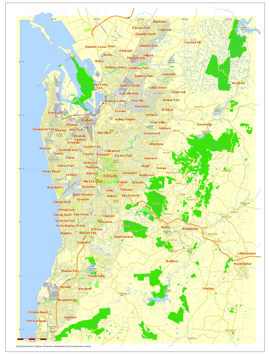
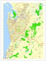
City map of the Adelaide metropolitan area.
Adelaide is north of the Fleurieu Peninsula, on the Adelaide Plains between the Gulf St Vincent and the low-lying Mount Lofty Ranges. The city stretches 20 km from the coast to the foothills, and 90 km from Gawler at its northern extent to Sellicks Beach in the south. According to the Regional Development Australia, an Australian government planning initiative, the "Adelaide Metropolitan Region" has a total land area of 870 km2, while a more expansive definition by the Australian Bureau of Statistics defines a "Greater Adelaide" statistical area totalling 3259.8 km2. The city sits at an average elevation of 50 m above sea level. Mount Lofty, east of the Adelaide metropolitan region in the Adelaide Hills at an elevation of 727 m, is the tallest point of the city and in the state south of Burra.
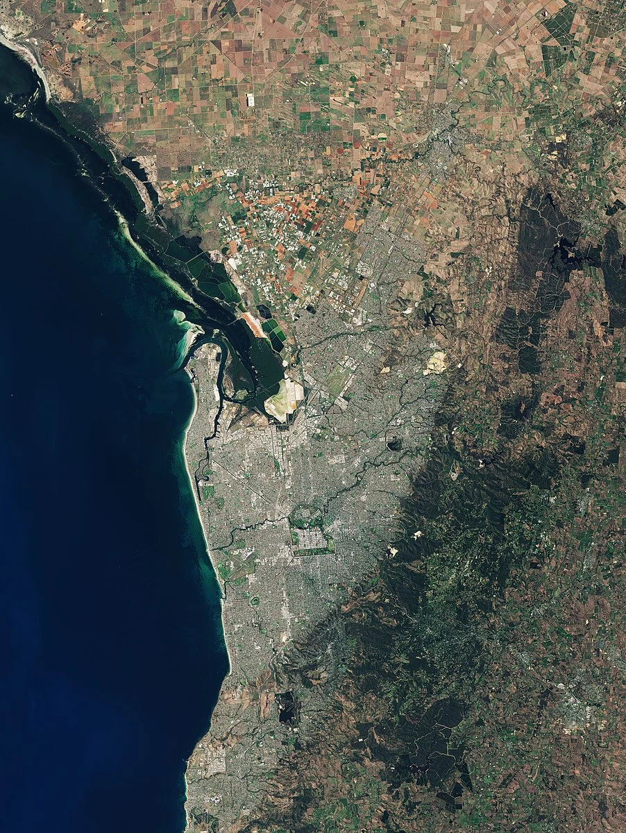
Adelaide's metropolitan area as seen by the ESA's Sentinel-2.
Much of Adelaide was bushland before British settlement, with some variation – sandhills, swamps and marshlands were prevalent around the coast. The loss of the sandhills to urban development had a particularly destructive effect on the coastline due to erosion. Where practical, the government has implemented programs to rebuild and vegetate sandhills at several of Adelaide's beachside suburbs. Much of the original vegetation has been cleared with what is left to be found in reserves such as the Cleland Conservation Park and Belair National Park. A number of creeks and rivers flow through the Adelaide region. The largest are the Torrens and Onkaparinga catchments. Adelaide relies on its many reservoirs for water supply with the Happy Valley Reservoir supplying around 40% and the much larger Mount Bold Reservoir 10% of Adelaide's domestic requirements respectively.
Geology[]
Adelaide and its surrounding area is one of the most seismically active regions in Australia. On 1 March 1954 at 3:40 am Adelaide experienced its largest recorded earthquake to date, with the epicentre 12 km from the city centre at Darlington, and a reported magnitude of 5.6.[16][17] There have been smaller earthquakes in 2010,[18] 2011,[19] 2014,[20] 2017,[21] and 2018.[22]
The uplands of the Adelaide Hills, part of the southern Mount Lofty Ranges to the east of Adelaide, are defined on their western side by a number of arcuate faults (the Para, Eden, Clarendon and Willunga Faults), and consist of rocks such as siltstone, dolomite and quartzite, dating from the Neoproterozoic to the middle Cambrian, laid down in the Adelaide Rift Complex, the oldest part of the Adelaide Superbasin.
Most of the Adelaide metropolitan area lies in the downthrown St Vincent Basin and its embayments, including the Adelaide Plains Sub-basin, and the Golden Grove, Noarlunga and Willunga Embayments. These basins contain deposits of Tertiary marine and non-marine sands and limestones, which form important aquifers.[23] These deposits are overlain by Quaternary alluvial fans and piedmont slope deposits, derived from erosion of the uplands, consisting of sands, clays and gravels,[24] interfingering to the west with transgressive Pleistocene to Holocene marine sands and coastal sediments of the shoreline of Gulf St Vincent.[25]
Urban layout[]
Further information - William Light
Adelaide is a planned city, designed by the first Surveyor-General of South Australia, Colonel William Light. His plan, sometimes referred to as "Light's Vision" (also the name of a statue of him on Montefiore Hill), arranged Adelaide in a grid, with five squares in the Adelaide city centre and a ring of parks, known as the Adelaide Parklands, surrounding it. Light's selection of the location for the city was initially unpopular with the early settlers, as well as South Australia's first governor, John Hindmarsh, due to its distance from the harbour at Port Adelaide, and the lack of fresh water there.[26] Light successfully persisted with his choice of location against this initial opposition. Recent evidence suggests that Light worked closely with George Kingston as well as a team of men to set out Adelaide, using various templates for city plans going back to Ancient Greece, including Italian Renaissance designs and the similar layouts of the American cities Philadelphia and Savannah–which, like Adelaide, follow the same layout of a central city square, four complementing city squares surrounding it and a parklands area that surrounds the city centre.
The benefits of Light's design are numerous: Adelaide has had wide multi-lane roads from its beginning, an easily navigable cardinal direction grid layout and an expansive green ring around the city centre. There are two sets of ring roads in Adelaide that have resulted from the original design. The inner ring route (A21) borders the parklands, and the outer route (A3/A13/A16/A17) completely bypasses the inner city via (in clockwise order) Grand Junction Road, Hampstead Road, Ascot Avenue, Portrush Road, Cross Road and South Road.
The corner of North Terrace (right) and Pulteney Street (left), looking south-west from near Bonython Hall.
Suburban expansion has to some extent outgrown Light's original plan. Numerous former outlying villages and "country towns", as well as the satellite city of Elizabeth, have been enveloped by its suburban sprawl. Expanding developments in the Adelaide Hills region led to the construction of the South Eastern Freeway to cope with growth, which has subsequently led to new developments and further improvements to that transport corridor. Similarly, the booming development in Adelaide's South led to the construction of the Southern Expressway.
New roads are not the only transport infrastructure developed to cope with the urban growth. The O-Bahn Busway is an example of a unique solution to Tea Tree Gully's transport woes in the 1980s. The development of the nearby suburb of Golden Grove in the late 1980s is an example of well-thought-out urban planning.

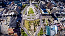
Aerial view of Victoria Square, one of the five main squares in the city centre and considered the heart of Adelaide's grid layout.
In the 1960s, a Metropolitan Adelaide Transport Study Plan was proposed to cater for the future growth of the city. The plan involved the construction of freeways, expressways and the upgrade of certain aspects of the public transport system. The then premier Steele Hall approved many parts of the plan and the government went as far as purchasing land for the project. The later Labor government elected under Don Dunstan shelved the plan, but allowed the purchased land to remain vacant, should the future need for freeways arise. In 1980, the Liberal party won government and premier David Tonkin committed his government to selling off the land acquired for the MATS plan, ensuring that even when needs changed, the construction of most MATS-proposed freeways would be impractical. Some parts of this land have been used for transport, (e.g. the O-Bahn Busway and Southern Expressway), while most has been progressively subdivided for residential use.
In 2008, the SA Government announced plans for a network of transport-oriented developments across the Adelaide metropolitan area and purchased a 10 hectare industrial site at Bowden for $52.5 million as the first of these developments.[27][28] The site covers 102,478 square metres, or about 10 hectares, and is bounded by Park Terrace to the south, the Adelaide to Outer Harbour railway line to the west, Drayton Street to the north and Sixth and Seventh Streets to the east.
Housing[]

Tranmere House, Tranmere. The heritage listed mansion was constructed in 1898 for Adelaidean shop merchant George Hunt (1845–1911).
Historically, Adelaide's suburban residential areas have been characterised by single-storey detached houses built on 1/4 acre blocks. A relative lack of suitable, locally-available timber for construction purposes led to the early development of a brick-making industry, as well as the use of stone, for houses and other buildings. By 1891 68% of houses were built of stone, 15% of timber, and 10% of brick, with brick also being widely used in stone houses for quoins, door and window surrounds, and chimneys and fireplaces.[29]
There is a wide variety in the styles of these houses. Until the 1960s most of the more substantial houses were built of red brick, though many front walls were of ornamental stone. Then cream bricks became fashionable, and in the 1970s, deep red and brown bricks became popular. Until the 1970s, roofs tended to be clad with (painted) corrugated iron or tiles (cement or clay, usually red "terracotta"). Since then, Colorbond corrugated steel has dominated. Most roofs are pitched; flat roofs are not common. Up to the 1970s, most houses were of "double brick" construction on concrete footings, with timber floors laid on joists supported by "dwarf walls". Later houses have mainly been of "brick veneer" construction – structural timber or, more recently, lightweight steel frame on a concrete slab foundation, lined with Gyprock, and with an outer skin of brickwork,[30] to cope with Adelaide's reactive soils, particularly Keswick Clay, black earth and some red-brown earth soils.[31] The use of precast concrete panels for floor and wall construction has also increased.[30] In addition to this, a significant factor in Adelaide's suburban history is the role of the South Australian Housing Trust.
Climate[]
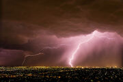
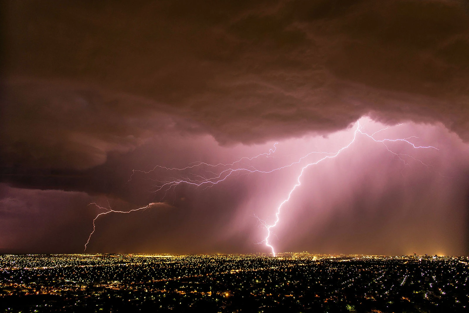
A spring storm over Adelaide
Adelaide has a mediterranean climate (Köppen climate classification: Csa). The city has hot, dry summers and cool winters with moderate rainfall. Most precipitation falls in the winter months, leading to the suggestion that the climate be classified as a "cold monsoon".[32] Rainfall is unreliable, light and infrequent throughout summer, although heavy falls can occur. In contrast, the winter has fairly reliable rainfall with June being the wettest month of the year, averaging around 80 mm. Frosts are occasional, with the most notable occurrences in July 1908 and July 1982. Hail is also common in winter. Adelaide is a windy city with significant wind chill in winter, which makes the temperature seem colder than it actually is. Snowfall in the metropolitan area is extremely uncommon, although light and sporadic falls in the nearby hills and at Mount Lofty occur during winter. Dewpoints in the summer typically range from 8 to 10°C. There are usually several days in summer where the temperature reaches 40.0°C or above; the frequency of these temperatures has been increasing in recent years. Temperature extremes range from -0.4 °C (31.4 °F), 8 June 1982 to 46.6 °C (115.9 °F), 24 January 2019.
The average sea temperature ranges from 13.7°C in August to 21.2°C in February.
Liveability[]
Adelaide has been consistently listed in the world's top 10 most liveable cities through the 2010s by The Economist Intelligence Unit, although it dropped to tenth place in 2018 after holding fifth position in the previous three years. It was ranked the most liveable city in Australia by the Property Council of Australia, based on surveys of residents’ views of their own city, between 2010 and 2013, dropping to second place in 2014.date=7 Greener spaces for sustainable living is an initiative that has proven to create happier residents and is one of the factors that contributes to Adelaide making the top 10 of the world's most liveable cities. For a relatively small city it boasts 29 large public parks as well as a botanical garden in the heart of the city. The reduction of Adelaide's tree canopy cover over recent years due to excessive tree removal for new construction has led to the creation of an urban heat island, an increase in the cost of housing and a decrease of overall state of well-being.
Governance[]
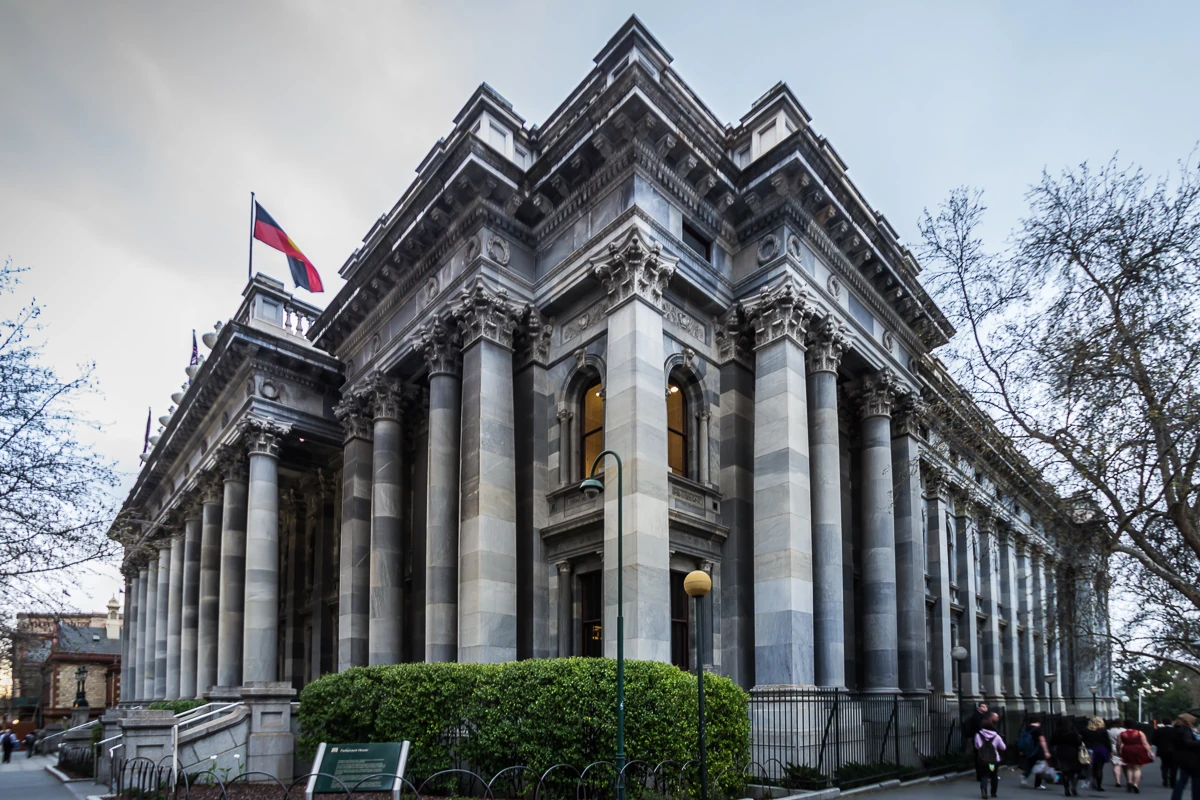
Parliament House, Adelaide
Adelaide, as the capital of South Australia, is the seat of the Government of South Australia as well as the bicameral Parliament of South Australia, which consists of the lower house known as the House of Assembly and the upper house known as the Legislative Council. General elections are held every four years, the last being the 2018 election. As Adelaide is South Australia's capital and most populous city, the State Government co-operates extensively with the City of Adelaide. In 2006, the Ministry for the City of Adelaide was created to facilitate the State Government's collaboration with the Adelaide City Council and the Lord Mayor to improve Adelaide's image. The State Parliament's Capital City Committee is also involved in the governance of the City of Adelaide, being primarily concerned with the planning of Adelaide's urban development and growth.[33]
Reflecting South Australia's status as Australia's most centralised state, Adelaide elects a substantial majority of the South Australian House of Assembly. Of the 47 seats in the chamber, 34 seats (three-quarters of the legislature) are based in Adelaide, and two rural seats include Adelaide suburbs.
Local governments[]
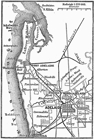
Local government areas of South Australia
The Adelaide metropolitan area is divided between nineteen local government areas. At its centre, the City of Adelaide administers the Adelaide city centre, North Adelaide, and the surrounding Adelaide Parklands. It is the oldest municipal authority in Australia and was established in 1840, when Adelaide and Australia's first mayor, James Hurtle Fisher, was elected. From 1919 onwards, the City has had a Lord Mayor, the current being Lord Mayor The Right Honourable Sandy Verschoor.
Demography[]
Adelaide's inhabitants are known as Adelaideans.
Compared with Australia's four other major state capitals, Adelaide is growing at a much slower rate. In 2017, it had a metropolitan population (including suburbs) of more than 1,345,777, Estimated resident population, 30 June 2018. making it Australia's fifth-largest city. Some 77% of the population of South Australia are residents of the Adelaide metropolitan area, making South Australia one of the most centralised states.
Major areas of population growth in recent years have been in outer suburbs such as Mawson Lakes and Golden Grove. Adelaide's inhabitants occupy 366,912 houses, 57,695 semi-detached, row terrace or town houses and 49,413 flats, units or apartments.
About one sixth (17.1%) of the population had university qualifications. The number of Adelaideans with vocational qualifications (such as tradespersons) fell from 62.1% of the labour force in the 1991 census to 52.4% in the 2001 census.
Adelaide is ageing more rapidly than other Australian capital cities. More than a quarter (27.5%) of Adelaide's population is aged 55 years or older, in comparison to the national average of 25.6%. Adelaide has the lowest number of children (under-15-year-olds), who comprised 17.7% of the population, compared to the national average of 19.3%.
Ancestry and immigration[]
| Country of Birth (2016) | Population |
| Australia | 884,250 |
| England | 80,795 |
| India | 26,270 |
| Mainland China | 23,919 |
| Italy | 17,398 |
| Vietnam | 13,932 |
| Philippines | 10,204 |
| New Zealand | 9,882 |
| Germany | 8,242 |
| Greece | 8,022 |
| Malaysia | 7,465 |
| Afghanistan | 5,847 |
| South Africa | 5,587 |
At the 2016 census, the most commonly nominated ancestries were: As a percentage of 1,227,355 persons who nominated their ancestry at the 2016 census.
- English (39%)
- Australian (33%). The Australian Bureau of Statistics has stated that most who nominate "Australian" as their ancestry are part of the Anglo-Celtic group.
- Scottish (8.7%)
- Irish (8.5%)
- German (7.2%)
- Italian (7.2%)
- Chinese (4.1%)
- Greek (2.9%)
- Indian (2.6%)
- Dutch (1.7%)
- Vietnamese (1.6%)
- Polish (1.4%)
- Indigenous (1.4%). Of any ancestry. Includes those identifying as Aboriginal Australians or Torres Strait Islanders. Indigenous identification is separate to the ancestry question on the Australian Census and persons identifying as Aboriginal or Torres Strait Islander may identify any ancestry.
- Filipino (1.1%)
Overseas-born Adelaideans composed 31.8% of the total population at the 2016 census. The five largest groups of overseas-born were from England (6.2%), India (2%), China (1.8%), Italy (1.3%) and Vietnam (1.1%).
Suburbs including Newton, Payneham and Campbelltown in the east and Torrensville, West Lakes and Fulham to the west, have large Greek and Italian communities. The Italian consulate is located in the eastern suburb of Payneham. Large Vietnamese populations are settled in the north-western suburbs of Woodville, Kilkenny, Pennington, Mansfield Park and Athol Park and also Parafield Gardens and Pooraka in Adelaide's north. Migrants from India and Sri Lanka have settled into inner suburban areas of Adelaide including the inner northern suburbs of Blair Athol, Kilburn and Enfield and the inner southern suburbs of Plympton, Park Holme and Kurralta Park.
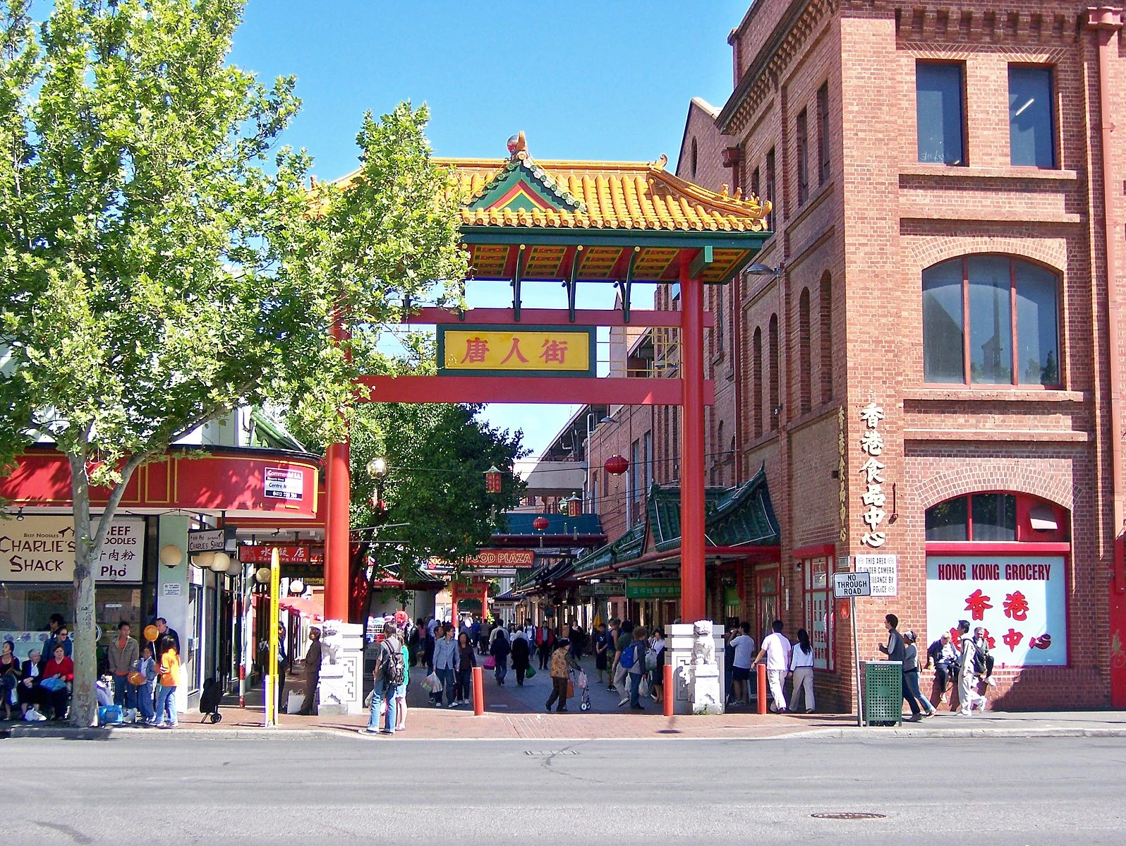
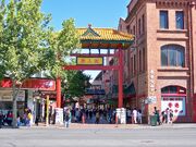
Chinatown on Moonta Street in the Market precinct
Suburbs such as Para Hills, Salisbury, Ingle Farm and Blair Athol in the north and Findon, West Croydon and Seaton and other Western suburbs have sizeable Afghan communities. Chinese migrants favour settling in the eastern and north eastern suburbs including Kensington Gardens, Greenacres, Modbury and Golden Grove. Mawson Lakes has a large international student population, due to its proximity to the University of South Australia campus.
1.4% of the population, or 18,403 people, identified as Indigenous Australians (Aboriginal Australians and Torres Strait Islanders) in 2016. Of any ancestry. Includes those identifying as Aboriginal Australians or Torres Strait Islanders. Indigenous identification is separate to the ancestry question on the Australian Census and persons identifying as Aboriginal or Torres Strait Islander may identify any ancestry.
Language[]
At the 2016 census, 75.4% of the population spoke English at home. The other languages most commonly spoken at home were Italian (2.1%), Standard Mandarin (2.1%), Greek (1.7%) Vietnamese (1.4%), and Cantonese (0.7%).
Religion[]

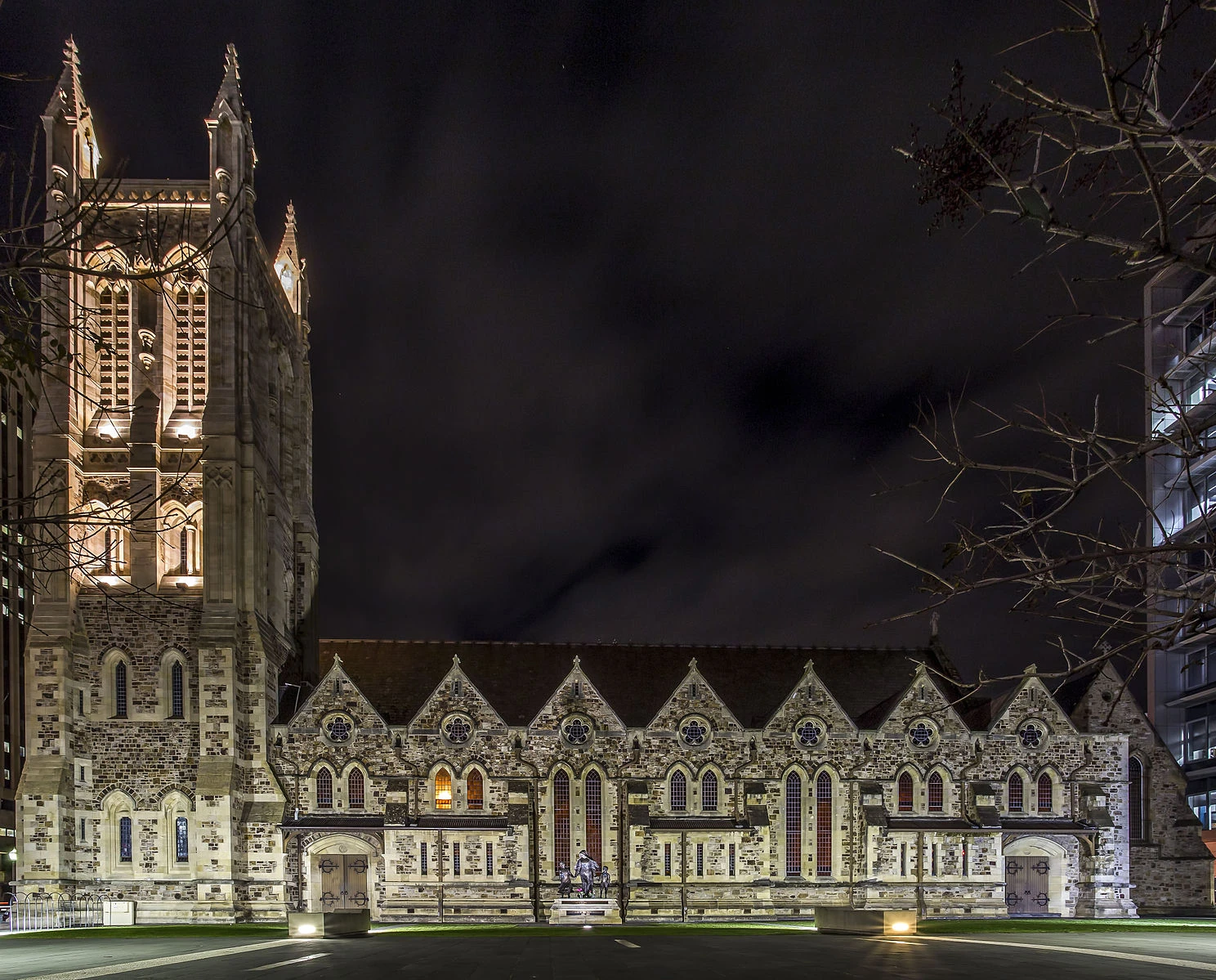
Saint Francis Xavier's Cathedral in Victoria Square
Adelaide was founded on a vision of religious tolerance that attracted a wide variety of religious practitioners. This led to it being known as The City of Churches., SA Memory. Retrieved 23 December 2010. But approximately 28% of the population expressed no religious affiliation in the 2011 Census, compared with the national average of 22.3%, making Adelaide one of Australia's least religious cities. Over half of the population of Adelaide identifies as Christian, with the largest denominations being Catholic (21.3%), Anglican (12.6%), Uniting Church (7.6%) and Eastern Orthodox (3.5%).
The Jewish community of the city dates back to 1840. Eight years later, 58 Jews lived in the city. In 1968, the Jewish population of Adelaide numbered about 1,200; in 2001, according to the Australian census, 979 persons declared themselves to be Jewish by religion. In 2011, over 1,000 Jews were living in the city, operating an Orthodox and a Reform school, in addition to a virtual Jewish museum.
The "Afghan" community in Australia first became established in the 1860s when camels and their Pathan, Punjabi, Baluchi and Sindhi handlers began to be used to open up settlement in the continent's arid interior. Until eventually superseded by the advent of the railways and motor vehicles, camels played an invaluable economic and social role in transporting heavy loads of goods to and from isolated settlements and mines. This is acknowledged by the name of The Ghan, the passenger train operating between Adelaide, Alice Springs, and Darwin. The Central Adelaide Mosque is regarded as Australia's oldest permanent mosque; an earlier mosque at Marree in northern South Australia, dating from 1861 to 1862 and subsequently abandoned or demolished, has now been rebuilt.
Economy[]
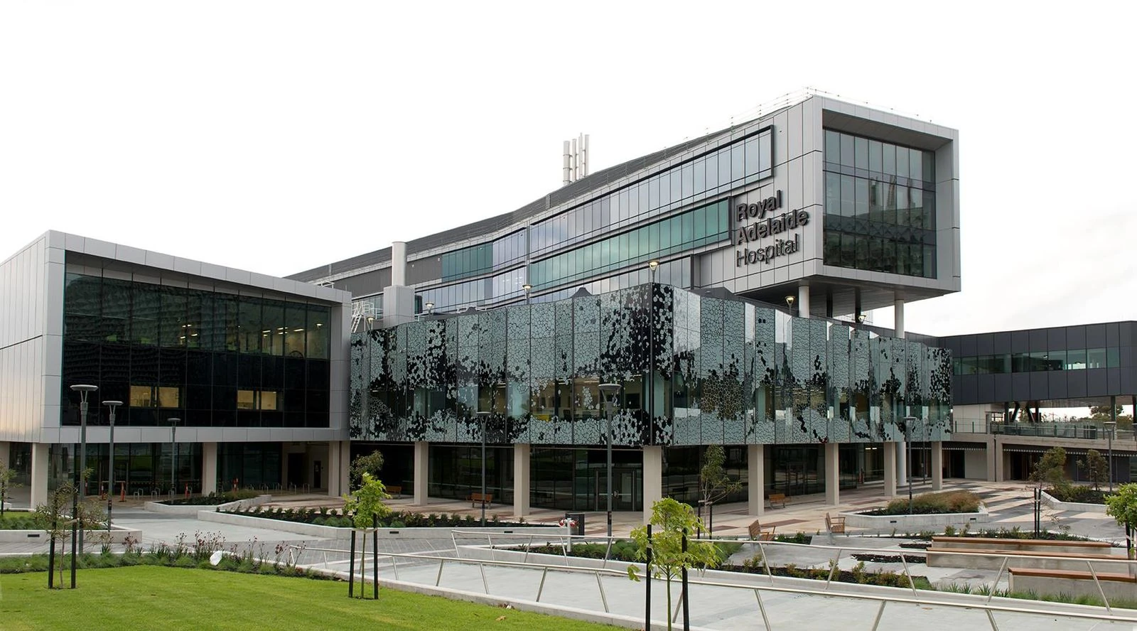
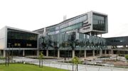
The new Royal Adelaide Hospital opened in 2017. Health care and social assistance is the largest ABS-defined employment sector in South Australia.
South Australia's largest employment sectors are health care and social assistance, surpassing manufacturing in SA as the largest employer since 2006–07. In 2009–10, manufacturing in SA had average annual employment of 83,700 persons compared with 103,300 for health care and social assistance. Health care and social assistance represented nearly 13% of the state average annual employment. The Adelaide Hills wine region is an iconic and viable economic region for both the state and country in terms of wine production and sale. The 2014 vintage is reported as consisting of 5836 t red grapes crushed valued at A$8,196,142 and 12,037 t white grapes crushed valued at $14,777,631.
The retail trade is the second largest employer in SA (2009–10), with 91,900 jobs, and 12 per cent of the state workforce.
Manufacturing, defence technology, high-tech electronic systems and research, commodity export and corresponding service industries all play a role in the SA economy. Almost half of all cars produced in Australia were made in Adelaide at the General Motors Holden plant in Elizabeth. The site ceased operating in November 2017.
The collapse of the State Bank in 1992 resulted in large levels of state public debt (as much as A$4 billion). The collapse meant that successive governments enacted lean budgets, cutting spending, which was a setback to the further economic development of the city and state. The debt has more recently been reduced with the State Government once again receiving a AAA+ Credit Rating.
The global media conglomerate News Corporation was founded in, and until 2004 incorporated in, Adelaide and it is still considered its 'spiritual' home by Rupert Murdoch. Australia's largest oil company, Santos, prominent South Australian brewery, Coopers, and national retailer Harris Scarfe also call Adelaide their home.
The city has been chosen to be the site of the new Australian space center. South Australia is already home to over 80 organisations which employ 800 people in the space sector.[34] The Prime Minister Scott Morrison stated the "agency will act as a launching pad to triple Australia's space economy to $12 billion and create up to 20,000 jobs by 2030."
Defence industry[]

,_enters_Pearl_Harbor_for_a_port_visit_after_completing_exercises_in_the_Pacific_region.jpg)
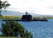
The Adelaide-built Collins submarine HMAS Rankin entering Pearl Harbor, August 2004.
Adelaide is home to a large proportion of Australia's defence industries, which contribute over A$1 billion to South Australia's Gross State Product.Visualised: How Defence dominates govt tenders in SA. The principal government military research institution, the Defence Science and Technology Organisation, and other defence technology organisations such as BAE Systems Australia and Lockheed Martin Australia, are north of Salisbury and west of Elizabeth in an area now called "Edinburgh Parks", adjacent to RAAF Base Edinburgh.
Others, such as Saab Systems and Raytheon, are in or near Technology Park. ASC Pty Ltd, is based in the industrial suburb of Osborne and is also a part of Technology Park. South Australia was charged with constructing Australia's Collins class submarines and more recently the A$6 billion contract to construct the Royal Australian Navy's new air-warfare destroyers.
Employment statistics[]
As of November 2015, Greater Adelaide had an unemployment rate of 7.4% with a youth unemployment rate of 15%.
The median weekly individual income for people aged 15 years and over was $447 per week in 2006, compared with $466 nationally. The median family income was $1,137 per week, compared with $1,171 nationally. Adelaide's housing and living costs are substantially lower than that of other Australian cities, with housing being notably cheaper. The median Adelaide house price is half that of Sydney and two-thirds that of Melbourne. The three-month trend unemployment rate to March 2007 was 6.2%. The Northern suburbs' unemployment rate is disproportionately higher than the other regions of Adelaide at 8.3%, while the East and South are lower than the Adelaide average at 4.9% and 5.0% respectively.
House prices[]
Over the decade March 2001 – March 2010, Metropolitan Adelaide median house prices approximately tripled. (approx. 285% – approx. 11%p.a. compounding) In the five years March 2007 – March 2012, prices increased by approx. 27% – approx. 5%p.a. compounding. March 2012 – March 2017 saw a further increase of 19% – approx. 3.5%p.a. compounding.
In summary:
| March | 2001 | 2002 | 2003 | 2004 | 2005 | 2006 | 2007 | 2008 | 2009 | 2010 |
|---|---|---|---|---|---|---|---|---|---|---|
| Median | $140,000 | $170,000 | $200,000 | $250,000 | $270,000 | $280,000 | $300,000 | $360,000 | $350,000 | $400,000 |
| % change | 21% | 18% | 25% | 8% | 4% | 7% | 20% | −3% | 14% | |
| March | 2011 | 2012 | 2013 | 2014 | 2015 | 2016 | 2017 | 2018 | 2019 | 2020 |
| Median | $400,000 | $380,000 | $393,000 | $413,000 | $425,000 | $436,000 | $452,000 | $470,000 | $478,500 | |
| % change | 0% | −5% | 3% | 5% | 3% | 3% | 4% | |||
| All numbers approximate and rounded. Since March 2012, the REISA no longer release a median house price for the Adelaide Metropolitan area, so figures retrieved are from Dept of the Premier and Cabinet. | ||||||||||
Each quarter, The Alternative and Direct Investment Securities Association (ADISA) publishes a list of median house sale prices by suburb and Local Government Area. (Previously, this was done by REISA) Due to the small sizes of many of Adelaide's suburbs, the low volumes of sales in these suburbs, and (over time) the huge variations in the numbers of sales in a suburb in a quarter, statistical analysis of "the most expensive suburb" is unreliable; the suburbs appearing in the "top 10 most expensive suburbs this quarter" list is constantly varying.
Education and research[]

Barr Smith Library, part of the University of Adelaide
Education forms an increasingly important part of the city's economy, with the South Australian Government and educational institutions attempting to position Adelaide as "Australia's education hub" and marketing it as a "Learning City." The number of international students studying in Adelaide has increased rapidly in recent years to 30,726 in 2015, of which 1,824 were secondary school students. In addition to the city's existing institutions, foreign institutions have been attracted to set up campuses to increase its attractiveness as an education hub. Adelaide is the birthplace of three Nobel laureates, more than any other Australian city: physicist William Lawrence Bragg and pathologists Howard Florey and Robin Warren, all of whom completed secondary and tertiary education at St Peter's College and the University of Adelaide.
Primary and secondary education[]
At the level of primary and secondary education, there are two systems of school education. There is a public system operated by the South Australian Government and a private system of independent and Catholic schools. All schools provide education under the South Australian Certificate of Education (SACE) or, to a lesser extent, the International Baccalaureate (IB), with Adelaide having the highest number of IB schools in Australia.
Tertiary education[]

.jpg)
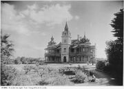
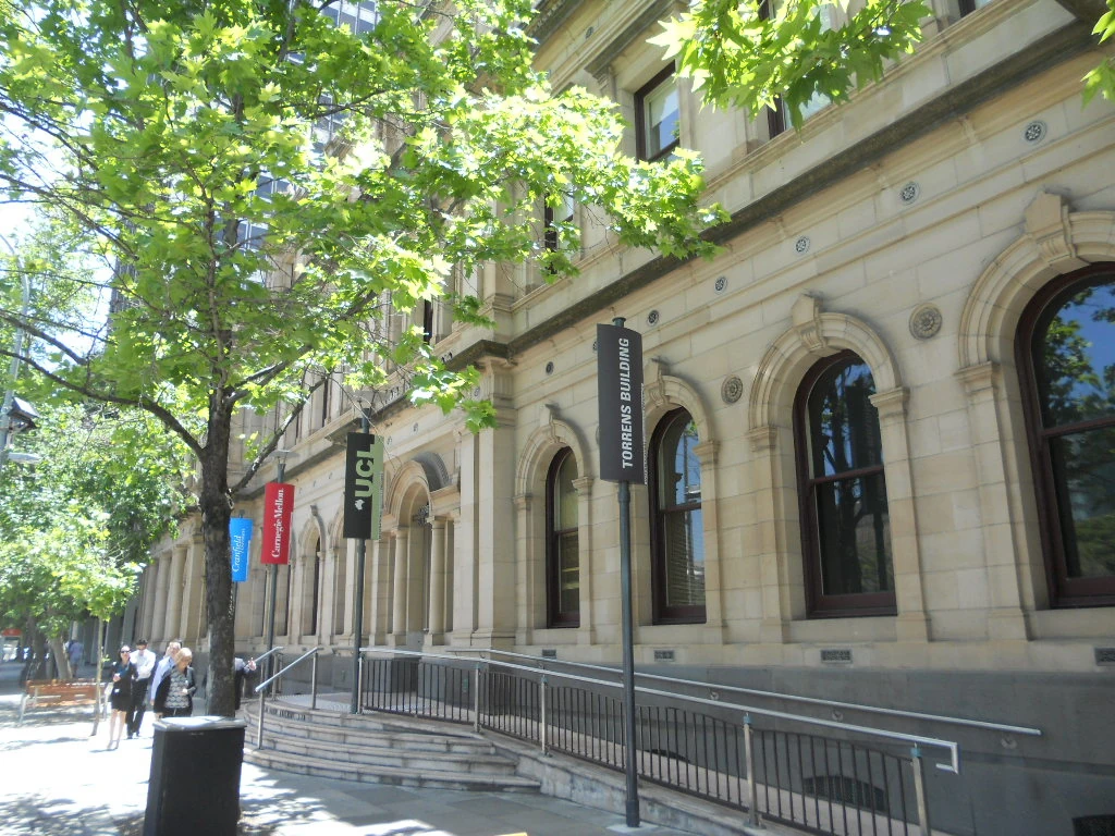
Historic Torrens Building in Victoria Square houses campuses of several international universities operating in South Australia.
There are three public universities local to Adelaide, as well as one private university and three constituent colleges of foreign universities. Flinders University of South Australia, the University of Adelaide, the University of South Australia and Torrens University Australia—part of the Laureate International Universities are based in Adelaide. The University of Adelaide was ranked in the top 150 universities worldwide. Flinders ranked in the top 250 and Uni SA in the top 300. Torrens University Australia is part of an international network of over 70 higher education institutions in more than 30 countries worldwide. The historic Torrens Building in Victoria Square[35] houses Carnegie Mellon University's Heinz College Australia, and University College London's School of Energy and Resources (Australia), and constitute the city's international university precinct.
The University of Adelaide, with 25,000 students, is Australia's third-oldest university and a member of the leading "Group of Eight". It has five campuses throughout the state, including two in the city-centre, and a campus in Singapore. The University of South Australia, with 37,000 students, has two North Terrace campuses, three other campuses in the metropolitan area and campuses at Whyalla and Mount Gambier. Flinders University, with 25,184 domestic and international students, is in the southern suburb of Bedford Park, alongside the Flinders Medical Centre, another campus in neighbouring Tonsley, and maintains a small city campus in Victoria Square. The plaza on the Bedford Park campus was revamped in 2014 and officially re-opened in 2016.
The Adelaide College of Divinity is at Brooklyn Park.
There are several South Australian TAFE (Technical and Further Education) campuses in the metropolitan area that provide a range of vocational education and training. The Adelaide College of the Arts, as a school of TAFE SA, provides nationally recognised training in visual and performing arts.
Research[]
In addition to the universities, Adelaide is home to a number of research institutes, including the Royal Institution of Australia, established in 2009 as a counterpart to the two-hundred-year-old Royal Institution of Great Britain. Many of the organisations involved in research tend to be geographically clustered throughout the Adelaide metropolitan area:
- The east end of North Terrace: SA Pathology; Hanson Institute; RAH; National Wine Centre.
- The west end of North Terrace: South Australian Health and Medical Research Institute (SAHMRI), located next to the new Royal Adelaide Hospital.
- The Waite Research Precinct: SARDI Head Office and Plant Research Centre; AWRI; CSIRO research laboratories. SARDI also has establishments at Glenside and West Beach.
- Edinburgh, South Australia: DSTO; BAE Systems (Australia); Lockheed Martin Australia Electronic Systems.
- Technology Park (Mawson Lakes): BAE Systems; Optus; Raytheon; Topcon; Lockheed Martin Australia Electronic Systems.
- Research Park at Thebarton: businesses involved in materials engineering, biotechnology, environmental services, information technology, industrial design, laser/optics technology, health products, engineering services, radar systems, telecommunications and petroleum services.
- Science Park (adjacent to Flinders University): Playford Capital.
- The Basil Hetzel Institute for Translational Health Research in Woodville the research arm of the Queen Elizabeth Hospital, Adelaide
- The Joanna Briggs Institute, a global research collaboration for evidence-based healthcare with its headquarters in North Adelaide.
Cultural life[]

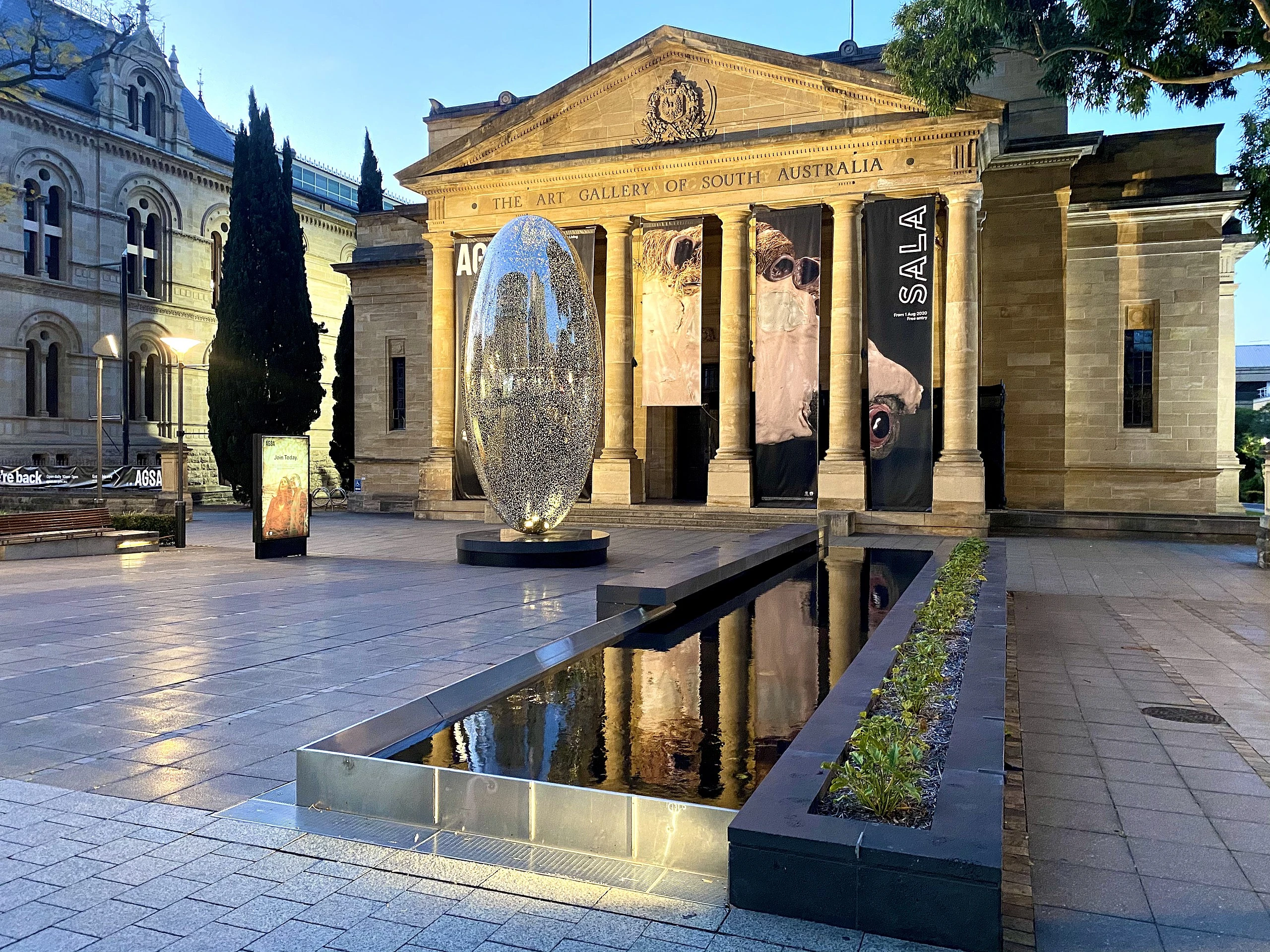
The Art Gallery of South Australia on North Terrace
- See also: South Australia#Cultural life, Department of the Premier and Cabinet (South Australia)#Arts and culture, List of festivals in Australia#South Australia
While established as a British province, and very much English in terms of its culture, Adelaide attracted immigrants from other parts of Europe early on, including German and other European non-conformists escaping religious persecution. The first German Lutherans arrived in 1838[36] bringing with them the vine cuttings that they used to found the acclaimed wineries of the Barossa Valley.
The Royal Adelaide Show is an annual agricultural show and state fair, established in 1839 and now a huge event held in the Adelaide Showground annually.
Adelaide's arts scene flourished in the 1960s and 1970s with the support of successive premiers from both major political parties. The renowned Adelaide Festival of Arts was established in 1960 under Thomas Playford, which in the same year spawned an unofficial uncurated series of performances and exhibits which grew into the Adelaide Fringe. Construction of the Adelaide Festival Centre began under Steele Hall in 1970 and was completed under the subsequent government of Don Dunstan, who also established the South Australian Film Corporation in 1972 and the State Opera of South Australia in 1976.
Over time, the Adelaide Festival expanded to include Adelaide Writers' Week and WOMADelaide, and other separate festivals were established, such as the Adelaide Cabaret Festival (2002), the Adelaide Festival of Ideas (1999), the Adelaide Film Festival (2013), FEAST (1999, a queer culture) and Tasting Australia (1997, a food and wine affair). With the Festival, the Fringe, WOMADelaide, Writers' Week and the Adelaide 500 street motor racing event (along with evening music concerts) all happening in early March, the period has become known colloquially as "Mad March".

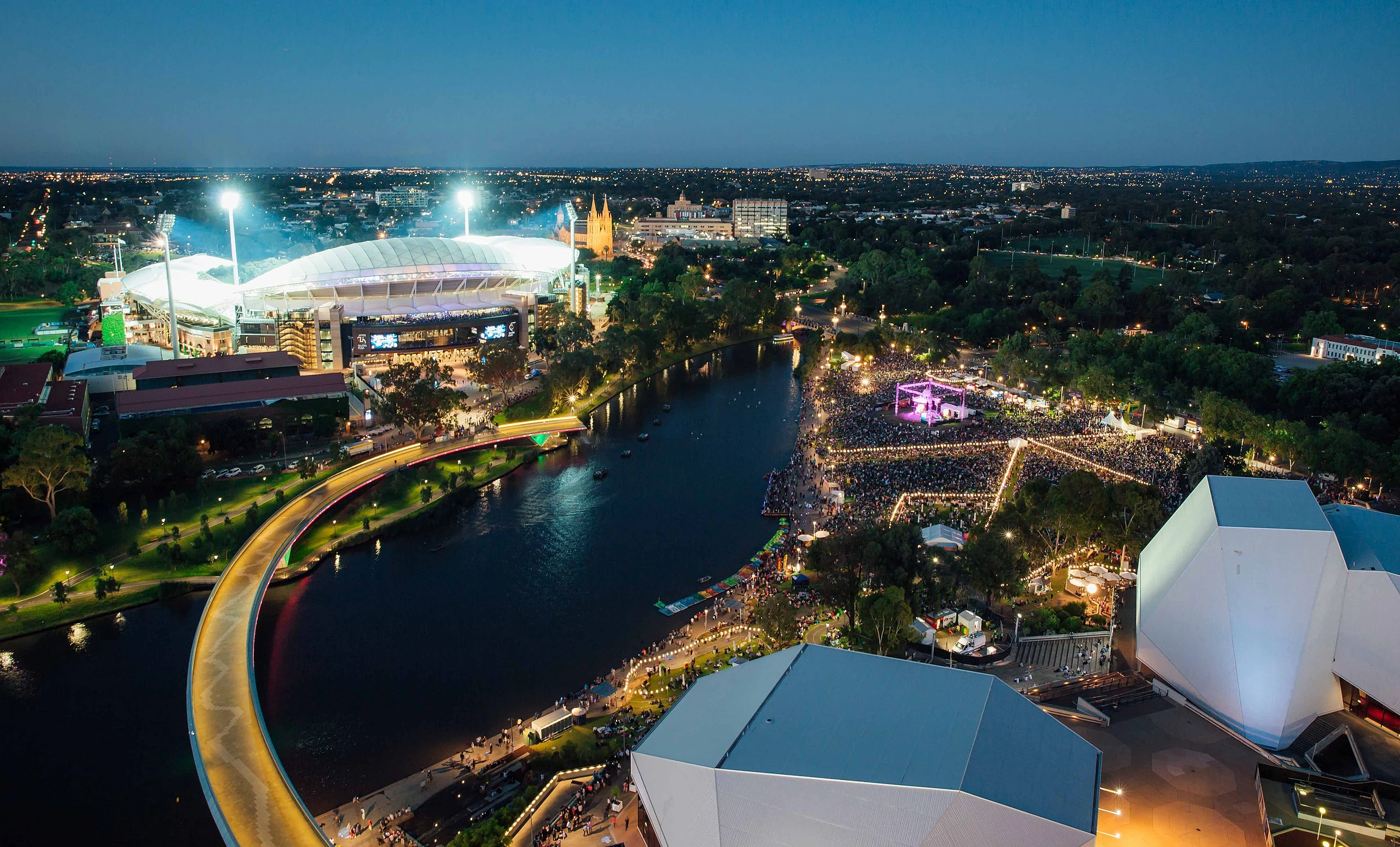
NYE celebrations in 2016 in Elder Park on the River Torrens, with Adelaide Oval and Adelaide Festival Centre also in view.
In 2014, Ghil'ad Zuckermann founded the Adelaide Language Festival.
There are many international cultural fairs, most notably the German Schützenfest and Greek Glendi. Adelaide is home to the Adelaide Christmas Pageant, the world's largest Christmas parade.
North Terrace institutions[]
As the state capital, Adelaide is home to a great number of cultural institutions with many along the boulevard of North Terrace. The Art Gallery of South Australia, with around 35,000 works, holds Australia's second largest state-based collection. Adjacent are the South Australian Museum and State Library of South Australia, while the Adelaide Botanic Garden, National Wine Centre and Tandanya National Aboriginal Cultural Institute are nearby in the East End of the city. In the back of the State Library lies the Migration Museum, Australia's oldest museum of its kind.
Further west, the Lion Arts Centre is home to ACE Open, which showcases contemporary art, Dance Hub SA and other studio and arts industry office spaces. The Mercury Cinema and JamFactory (ceramics and design gallery) are just around the corner.
Performing arts and music venues[]

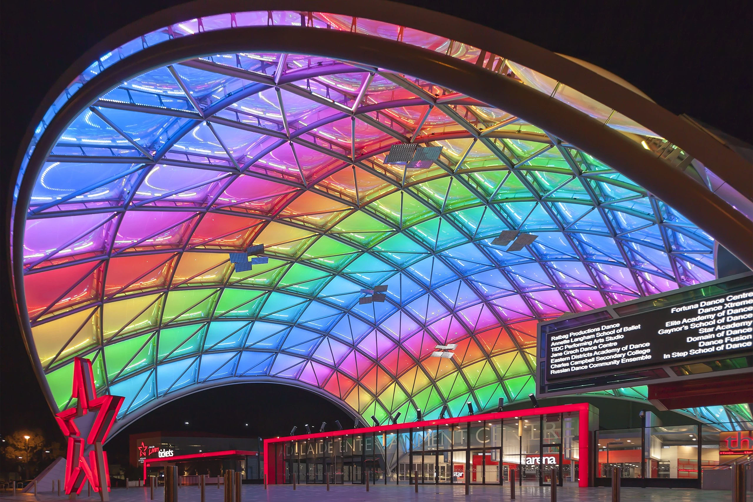
The Adelaide Entertainment Centre, the largest indoor sports and entertainment venue in Adelaide
The Adelaide Festival Centre (which includes the Dunstan Playhouse, Festival Theatre and Space Theatre), on the banks of the Torrens, is the focal point for much of the cultural activity in the city and home to the State Theatre Company of South Australia. Other live music and theatre venues include the Adelaide Entertainment Centre; Adelaide Oval; Memorial Drive Park; Thebarton Theatre; Adelaide Town Hall; Her Majesty's Theatre; Queen's Theatre; Holden Theatres and the Hopgood Theatre.
The Lion Arts Factory, within the Lion Arts Centre, hosts contemporary music in a wide range of genres, as does "The Gov" in Hindmarsh. The city also has numerous smaller theatres, pubs and cabaret bars which host performances.
Live music[]

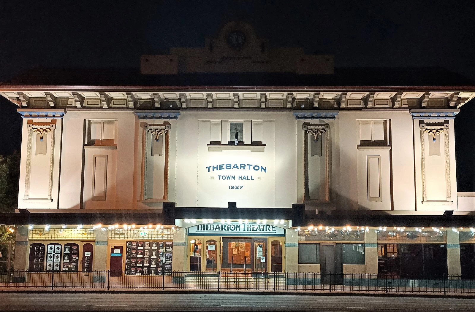
The Thebarton Theatre, colloquially known as the 'Thebby', is one of South Australia's most popular live music venues.
Further - Music of Adelaide
In 2015, it was said that there were now more live music venues per capita in Adelaide than any other capital city in the southern hemisphere, Lonely Planet labelled Adelaide "Australia's live music city", and the city was recognised as a "City of Music" by the UNESCO Creative Cities Network.
In addition to its own WOMADelaide, Adelaide attracts several touring music festivals, including Creamfields, Laneway and Groovin'.
Adelaide has produced musical groups and individuals who have achieved national and international fame. These include the Adelaide Symphony Orchestra, the Adelaide Youth Orchestra, rock bands The Angels, Cold Chisel, The Superjesus, Wolf & Cub, roots/blues group The Audreys, internationally acclaimed metal acts I Killed The Prom Queen and Double Dragon, popular Australian hip-hop outfit Hilltop Hoods, pop acts like Sia, Orianthi, Guy Sebastian, and Wes Carr, as well as internationally successful tribute act, The Australian Pink Floyd Show.
Noted rocker Jimmy Barnes (formerly lead vocalist with Cold Chisel) spent most of his youth in the northern suburb of Elizabeth. Paul Kelly grew up in Adelaide and was head prefect at Rostrevor College. The first Australian Idol winner, Guy Sebastian, hails from the north-eastern suburb of Golden Grove.
Dance[]
Adelaide plays host to two of Australia's leading contemporary dance companies. The Australian Dance Theatre and Dance Hub SA (formerly Leigh Warren & Dancers) contribute to state festivals and perform nationally and internationally. Restless Dance Theatre is also based in Adelaide and is nationally recognised for working with disabled and non-disabled dancers to use movement as a means of expression.
Media[]

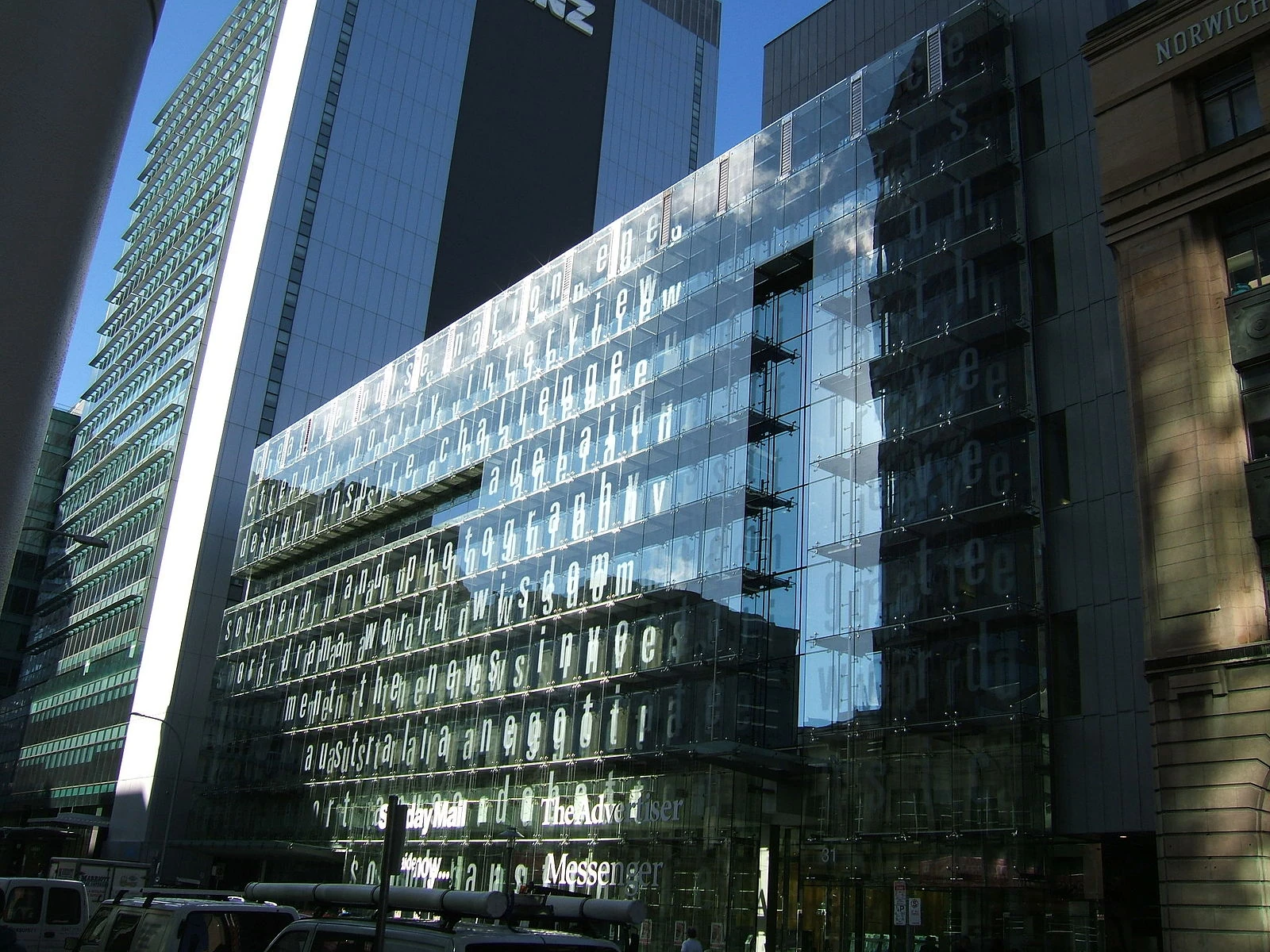
Sir Keith Murdoch House, named after the founder of The News, is the headquarters for the publisher of Adelaide's daily newspaper, The Advertiser.
Newspapers[]
Newspapers in Adelaide are dominated by News Corporation publications—Adelaide being the birthplace of News Corporation itself. The only South Australian daily newspaper is The Advertiser, published by News Corporation six days a week. The same group publishes a Sunday paper, the Sunday Mail.
There are eleven suburban community newspapers published weekly, known collectively as the Messenger Newspapers, also published by a subsidiary of News Corporation. The Independent Weekly was a small independent newspaper providing an alternative view, but ceased publishing its print edition in November 2010 and now exists as a digital daily newsletter only, InDaily. The Adelaide Review is a free paper published monthly, and other independent magazine-style papers are published, but are not as widely available.
Television[]
Adelaide is served by numerous digital free-to-air television channels:
- ABC
- ABC (ABC broadcast in HD)
- ABC TV Plus
- ABC Me
- ABC News
- SBS
- SBS HD (SBS broadcast in HD)
- SBS World Movies HD
- SBS Viceland HD
- SBS Food
- NITV
- Seven
- 7HD (Seven broadcast in HD)
- 7Two
- 7mate
- 7flix
- Racing.com
- Nine
- 9HD (Nine broadcast in HD)
- 9Gem
- 9Go!
- 9Life
- 9Rush
- Ten
- Ten HD (Ten broadcast in HD)
- 10 Bold
- 10 Peach
- 10 Shake
- TVSN
- Spree TV
- C44 Adelaide (Adelaide's community TV station)
All of the five Australian national television networks broadcast both high-definition digital and standard-definition digital television services in Adelaide. They share three transmission towers on the ridge near the summit of Mount Lofty. There are two other transmission sites at 25 Grenfell Street, Adelaide and Elizabeth Downs. The two government-funded stations are run by the Australian Broadcasting Corporation (ABC South Australia) and the Special Broadcasting Service (SBS). The Seven Network and Network Ten both own their Adelaide stations (SAS-7 and ADS-10 respectively). Adelaide's NWS-9 is part of the Nine Network. Adelaide also has a community television station, Channel 44.
As part of a nationwide phase-out of analogue television in Australia, Adelaide's analogue television service was shut down on 2 April 2013.
The Foxtel pay TV service is also available via cable or satellite to the entire metropolitan area.
All the major broadcasting networks also operate online on-demand television services, alongside internet-only services such as Stan, Fetch TV, Netflix, YouTube, Disney+, and Kayo Sports.
Radio[]
There are 20 radio stations that serve the metropolitan area, as well as four stations that serve only parts of the metropolitan area; six commercial stations, six community stations, six national stations and two narrowcast stations. DAB+ digital radio has been broadcasting in metropolitan Adelaide since 20 May 2009, and currently offers a choice of 41 stations all operated by the existing licensed radio broadcasters, which includes high-quality simulcast of all AM and FM stations.
See also[]
| This page uses Creative Commons Licensed content from Wikipedia (view authors). |
- ↑ Wakefield cites:
- Edward Curr, An Account of the Colony of Van Diemen's Land, principally designed for the use of emigrants, George Cowie & Co., London, 1824;
- Henry Widdowson, Present State of Van Diemen's Land; comprising an account of its agricultural capabilities, with observations on the present state of farming, &c. &c. pursued in that colony: and other important matters connected with Emigration, S. Robinson, W. Joy and J. Cross, London, and J. Birdsall, Northampton, 1829; and
- James Atkinson, An Account of the State of Agriculture & Grazing in New South Wales; Including Observations on the Soils and General Appearance of the Country, and some of its most useful natural productions; with an account of the Various Methods of Clearing and Improving Lands, Breeding and Grazing Live Stock, Erecting Buildings, the System of employing Convicts, and the expense of Labour generally; the Mode of Applying for Grants of Land; with Other Information Important to those who are about to emigrate to that Country: The result of several years' residence and practical experience in those matters in the Colony., J. Cross, London, 1826
- ↑ Wakefield, Letter from Sydney, December 1829, pp. 99–185, written from Newgate prison. Editor Robert Gouger.
- ↑ Wakefield wrote about this under a pseudonym, purporting to be an Australian settler. His subterfuge was so successful that he confused later writers, including [[Wikipedia:Karl Marx|]], who wrote "It is the great merit of E.G. Wakefield to have discovered not anything new about the Colonies, but to have discovered in the Colonies the truth of as to the condition of capitalist production in the mother-country.' Das Kapital, Moscow, 1958, p 766"
- ↑ Plan of a Company to be Established for the Purpose of Founding a Colony in Southern Australia, Purchasing Land Therein, and Preparing the Land so Purchased for the Reception of Immigrants, 1832; in Wakefield, Edward Gibbon, Prichard, M. F., (ed.) The Collected Works of Edward Gibbon Wakefield, Collins, London, 1968, p 290.
- ↑ J. W. Bull; Early Experiences of Colonial Life in South Australia (Adelaide, 1878) p.67
- ↑ F.K. Crowley, Modern Australia in Documents: 1901–1939
- ↑ Cockburn, S (1991): Playford – Benevolent Despot. Axiom Publishing. P. 85.
- ↑ Michael Owen, The Australian, 3 December 2009
- ↑ ABC News, Wednesday 7 June 2006
- ↑ ABC News, 6 April 2005
- ↑ ABC News, 13 May 2009
- ↑ ABC News, 29 June 2011
- ↑ News Release Government of SA, 15 May 2005
- ↑ Nick Harmsen, ABC News, 11 September 2007
- ↑ Adelaide Advertiser 26 February 2010
- ↑ C. Kerr-Grant (1955): The Adelaide Earthquake of 1 March 1954 (PDF). South Australian Museum, 10 November 1955. Retrieved 5 April 2009.
- ↑ Adelaide, SA: Earthquake. EMA Disasters Database. Emergency Management Australia, 13 September 2006. Retrieved 5 April 2009.
- ↑ Adelaide hit by earth tremor, ABC News, 17 April 2010. Retrieved 12 April 2018.
- ↑ Shallow earthquake jolts Adelaide awake, ABC News, 20 October 2011. Retrieved 12 April 2018.
- ↑ Adelaide shaken by earth tremor which sounded like 'jet taking off', ABC News, 6 January 2014. Retrieved 12 April 2018.
- ↑ Tremor shakes Adelaide nine days after larger earthquake in city, ABC News, 10 February 2017. Retrieved 12 April 2018.
- ↑ Earthquake near Mannum felt across Adelaide suburbs and hills rumbled 'like a train', ABC News, 9 August 2018. Retrieved 12 September 2019.
- ↑ Lindsay J.M. & Alley, N.F. (1995): St Vincent Basin. In: Drexel, J.F. & Preiss, W.V. (Eds.) The geology of South Australia. Vol.2, The Phanerozoic. pp. 163-171. South Australia Geological Survey, Bulletin 54.
- ↑ Callan, R.A., Sheard, M.J., Benbow, M.C. & Belperio, A.P. (1995): Alluvial fans and piedmont slope deposits. In: Drexel, J.F. & Preiss, W.V. (Eds.) The geology of South Australia. Vol.2, The Phanerozoic. pp. 241-242. South Australia Geological Survey, Bulletin 54.
- ↑ Belperio, A.P. (1995): Coastal and marine sequences. In: Drexel, J.F. & Preiss, W.V. (Eds.) The geology of South Australia. Vol.2, The Phanerozoic. pp. 220-240. South Australia Geological Survey, Bulletin 54.
- ↑ Page, M. (1981): Port Adelaide and its Institute, 1851–1979. Rigby Publishers Ltd. Pp.17–20.
- ↑ "Clipsal site at Bowden to become a green village", Ministerial Press Release, 24 October 2008, SA Govt. Retrieved 20 November 2008.
- ↑ "Government reveals Clipsal site purchase price", Ministerial Press Release, 15 November 2008, SA Govt, archived. Retrieved 27 November 2018.
- ↑ Gibbs, R.M. (2013): Under the burning sun: a history of colonial South Australia, 1836–1900. Peacock Publications. Pp. 58, 333–4.
- ↑ 30.0 30.1 Rosemary Cadden: Building South Australia: celebrating 125 years. Solstice Media. pp. 77, 87.
- ↑ Sheard, M. J., & A. P. Belperio (1995): "Problem soils". In: Drexel, J. F. & Preiss, W. V. (eds.) The geology of South Australia. Vol.2, The Phanerozoic. p. 274. South Australia Geological Survey, Bulletin 54.
- ↑ What's a 'cold monsoon'? And is it the best way to describe Adelaide's climate?, ABC News, 3 May 2018. Retrieved 30 May 2018.
- ↑ Capital City Committee Retrieved 29 September 2020.
- ↑ https://www.abc.net.au/news/2018-12-11/australian-space-agency-to-be-based-in-adelaide/10608202
- ↑ The historic Torrens Building in Victoria Square was beautifully restored at (considerable) taxpayer expense not long before SA Premier Mike Rann announced that it would be used as the core of Adelaide's international university precinct.
- ↑ Monteath, P., Paul, M., & Martin, R. (2014): Interned: Torrens Island 1914–1915, Wakefield Press, p. 8