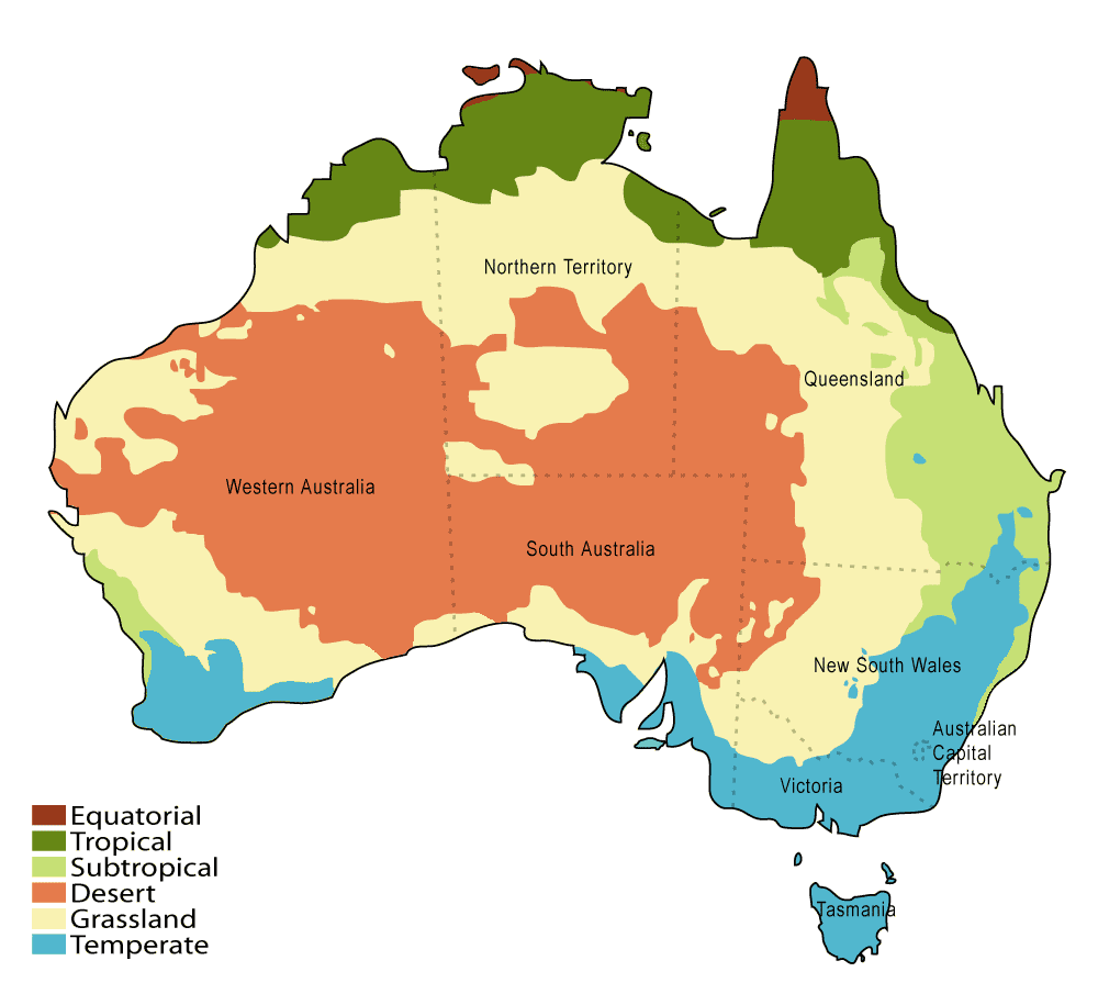
Climatic zones in Australia.
Australia's 7,686,850 km² (2,967,909 mi²) landmass is on the Indo-Australian Plate. Surrounded by the Indian, Southern and Pacific oceans, Australia is separated from Asia by the Arafura and Timor seas. Australia has a total 25,760 km (16,007 mi) of coastline and claims an extensive Exclusive Economic Zone of 8,148,250 km² or 3,146,057 mi² (excluding the Australian Antarctic Territory). Climate is highly influenced by ocean currents, including the El Niño southern oscillation, which is correlated with periodic drought, and the seasonal tropical low pressure system that produces cyclones in northern Australia.
By far the largest part of Australia is desert or semi-arid. Australia is the driest inhabited continent, the flattest, and has the oldest and least fertile soils. Only the south-east and south-west corners of the continent have a temperate climate. The northern part of the country, with a tropical climate, has a vegetation consisting of rainforest, woodland, grassland and desert. The Great Barrier Reef, the world's largest coral reef, lies a short distance off the north-east coast and extends for over 2,000 km (1,250 mi). The world's two largest monoliths are located in Australia, Mount Augustus in Western Australia is the largest and Uluru in central Australia is the second largest. At 2,228 m (7,310 foot), Mount Kosciuszko on the Great Dividing Range is the highest mountain on the Australian mainland, although Mawson Peak on the remote Australian territory of Heard Island is taller at 2,745 m (9,006 ft).
There is a continuing debate over whether recent droughts and floods are caused by climate change.